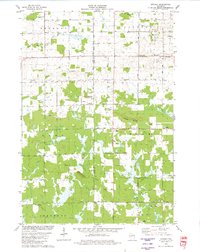
1979 Map of Lindsey
USGS Topo · Published 1980About this map
Lindsey sits at the heart of this late-1970s landscape where the borders of Wood and Clark Counties meet. The terrain is defined by low-lying wetlands and subtle elevations like Burdock Mound and Espey Mound, along with the notable Lindsey Bluffs. A network of rural infrastructure supports the local agricultural economy, including the Nasonville Sch and Grace Ch near the eastern boundary. The presence of an Old Railroad Grade cutting across the central portion of the sheet provides evidence of former transport corridors through the marshes. Waterways are abundant, with the East Fork Black River and Yellow River draining the township lands. To the south, the local Townhall and Rock Cem serve as focal points for the township of Cary, while numerous gravel pits and sandpits indicate the active extraction of natural resources from the glacial drift common to this part of Wisconsin.
Find a feature on this map
38 named features on this map. Tap any name to fly to it.
Don’t see what you’re looking for? This feature index may not catch every label — zoom into the map to look around manually.
Map Details
Editions of this 1979 Lindsey Map
This is the sole edition of this map. No revisions or reprints were ever made.
Other maps of this area

1953 · Eau Claire
USGS Topo · 1:250,000

1954 · Granton
USGS Topo · 1:62,500

1954 · Marshfield
USGS Topo · 1:62,500

1957 · Pittsville
USGS Topo · 1:48,000

1957 · City Point
USGS Topo · 1:48,000

1958 · Eau Claire
USGS Topo · 1:250,000

1964 · Eau Claire
USGS Topo · 1:250,000

1967 · Pittsville
USGS Topo · 1:62,500

1970 · City Point NE
USGS Topo · 1:24,000
1970 · City Point NW
USGS Topo · 1:24,000