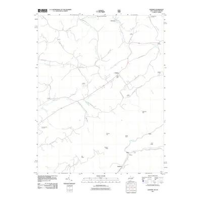
2011 Map of Lindside
USGS Topo · Published 2011About this map
Lindside serves as a central hub in this Appalachian landscape, where the Lindside Post Office anchors a network of rural routes including Spangler Rd and Rich Creek Valley Rd. The terrain is defined by its gaps and ridges, notably Dickinson Gap and Mystery Ridge, which direct the flow of numerous waterways like Hans Creek and Rich Creek. Genealogists will find a high density of family-named burial sites scattered across the countryside, including Mountain View Cemetery, Lively Cemetery, and Swope Cemetery in the north, stretching down to Reed Cemetery near Goldbond. This map illustrates a transition from the agricultural valley floors to the more complex topography of Flat Ridge and Fork Ridge, where the winding paths of Stony Creek and Crooked Creek carve through the limestone-influenced landscape of Monroe County.
Find a feature on this map
59 named features on this map. Tap any name to fly to it.
Don’t see what you’re looking for? This feature index may not catch every label — zoom into the map to look around manually.
Map Details
Editions of this 2011 Lindside Map
This is the sole edition of this map. No revisions or reprints were ever made.
Other maps of this area

1887 · Hinton
USGS Topo · 1:125,000

1890 · Dublin
USGS Topo · 1:125,000

1891 · Dublin
USGS Topo · 1:125,000

1892 · Hinton
USGS Topo · 1:125,000

1912 · Big Bend
USGS Topo · 1:62,500

1913 · Peterstown
USGS Topo · 1:48,000

1914 · Big Bend
USGS Topo · 1:62,500

1916 · Peterstown
USGS Topo · 1:62,500

1921 · Alderson
USGS Topo · 1:48,000

1923 · Pearisburg
USGS Topo · 1:62,500