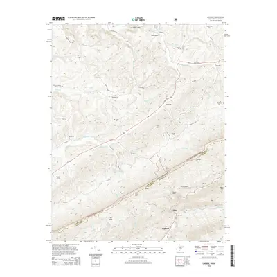
2014 Map of Lindside
USGS Topo · Published 2014About this map
Lindside and Assurance sit within a landscape shaped by the ridge-and-valley terrain of the Appalachian borderlands, where the West Virginia and Virginia state line follows the high crest of Peters Mountain. This survey reflects a rural corridor centered on the Seneca Trail S, where family cemeteries like Swope Cemetery and Broyles Cemetery are tucked into the drainages of Hans Creek and Blue Lick Creek. The terrain is marked by significant topographical gaps, including Symms Gap and Dickinson Gap, which served as historical passage points through the mountain barriers. Much of the southern portion of the map is dominated by the Jefferson National Forest, preserving the wooded slopes of Mystery Ridge and Flat Ridge. The map also details local agricultural and recreational features, such as an Orchard near Fitz Run and the Fountain Springs Golf Course along the banks of Crooked Creek.
Find a feature on this map
68 named features on this map. Tap any name to fly to it.
Don’t see what you’re looking for? This feature index may not catch every label — zoom into the map to look around manually.
Map Details
Editions of this 2014 Lindside Map
This is the sole edition of this map. No revisions or reprints were ever made.
Other maps of this area

1887 · Hinton
USGS Topo · 1:125,000

1890 · Dublin
USGS Topo · 1:125,000

1891 · Dublin
USGS Topo · 1:125,000

1892 · Hinton
USGS Topo · 1:125,000

1912 · Big Bend
USGS Topo · 1:62,500

1913 · Peterstown
USGS Topo · 1:48,000

1914 · Big Bend
USGS Topo · 1:62,500

1916 · Peterstown
USGS Topo · 1:62,500

1921 · Alderson
USGS Topo · 1:48,000

1923 · Pearisburg
USGS Topo · 1:62,500