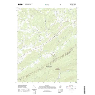
2019 Map of Lindside
USGS Topo · Published 2019About this map
Lindside and Assurance sit within a landscape of ridge-and-valley terrain near the West Virginia-Virginia border. This area is characterized by a dense network of country roads such as Koontz Rd and Pine Grove Rd, which connect small settlements and family burial grounds like Swope Cem and Broyles Cem. The southern portion of the map transitions into the Jefferson National Forest, where the Appalachian National Scenic Trail traverses the high ridges, passing through Symms Gap and Dickinson Gap. Numerous water sources, including Rich Creek Spring and the Mercer Anglers Club Spring, highlight the region's karstic geology and provide vital headwaters for streams like Rich Cr and Hans Cr. This 2019 survey documents the enduring rural character of Monroe County, with narrow hollows such as Thistle Hollow Rd preserving a traditional Appalachian settlement pattern.
Find a feature on this map
72 named features on this map. Tap any name to fly to it.
Don’t see what you’re looking for? This feature index may not catch every label — zoom into the map to look around manually.
Map Details
Editions of this 2019 Lindside Map
This is the sole edition of this map. No revisions or reprints were ever made.
Other maps of this area

1887 · Hinton
USGS Topo · 1:125,000

1890 · Dublin
USGS Topo · 1:125,000

1891 · Dublin
USGS Topo · 1:125,000

1892 · Hinton
USGS Topo · 1:125,000

1912 · Big Bend
USGS Topo · 1:62,500

1913 · Peterstown
USGS Topo · 1:48,000

1914 · Big Bend
USGS Topo · 1:62,500

1916 · Peterstown
USGS Topo · 1:62,500

1921 · Alderson
USGS Topo · 1:48,000

1923 · Pearisburg
USGS Topo · 1:62,500