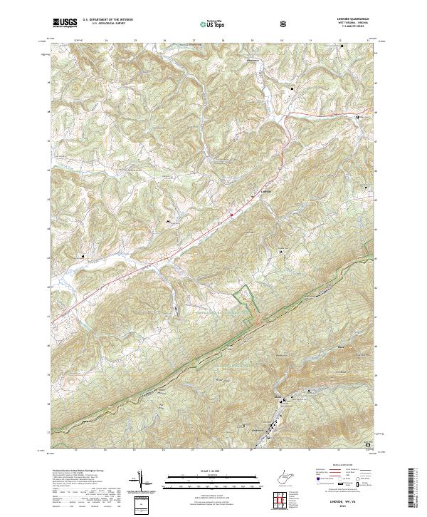
2023 Map of Lindside
USGS Topo · Published 2023About this map
Lindside and Assurance sit at the northern edge of this landscape, where the valley floor is etched by Hans Creek and Blue Lick Creek. This 2023 edition highlights a deep-rooted rural geography defined by family-named landmarks and historical burial grounds, including the Broyles Cem and Karnes Cem. The terrain rises sharply toward the southeast, where the Appalachian National Scenic Trail traverses the high ridge of Peters Mountain along the state line between West Virginia and Virginia.
Find a feature on this map
89 named features on this map. Tap any name to fly to it.
Don’t see what you’re looking for? This feature index may not catch every label — zoom into the map to look around manually.
Map Details
Editions of this 2023 Lindside Map
This is the sole edition of this map. No revisions or reprints were ever made.
Other maps of this area

1887 · Hinton
USGS Topo · 1:125,000

1890 · Dublin
USGS Topo · 1:125,000

1891 · Dublin
USGS Topo · 1:125,000

1892 · Hinton
USGS Topo · 1:125,000

1912 · Big Bend
USGS Topo · 1:62,500

1913 · Peterstown
USGS Topo · 1:48,000

1914 · Big Bend
USGS Topo · 1:62,500

1916 · Peterstown
USGS Topo · 1:62,500

1921 · Alderson
USGS Topo · 1:48,000

1923 · Pearisburg
USGS Topo · 1:62,500