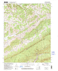
1998 Map of Lindside
USGS Topo · Published 2001About this map
Peters Mountain anchors the southern landscape of this Appalachian borderland, where the boundary between West Virginia and Virginia follows the high ridge. This late-century survey captures a rural environment defined by narrow valleys and persistent family-named landmarks. The village of Lindside serves as a central point, surrounded by a network of country churches including Pine Grove Ch and Dry Pond Ch. The terrain transitions from the open lands of Red Sulphur and Springfield to the heavily forested slopes of the Jefferson National Forest. Industrial activity is concentrated near the southern margin, where quarries and the Goldbond settlement sit near the Kimballton Sch. Hikers and local historians can trace the Appalachian Trail as it winds along the crest through Symms Gap and past Foster Knob.
Find a feature on this map
43 named features on this map. Tap any name to fly to it.
Don’t see what you’re looking for? This feature index may not catch every label — zoom into the map to look around manually.
Map Details
Editions of this 1998 Lindside Map
This is the sole edition of this map. No revisions or reprints were ever made.
Other maps of this area

1887 · Hinton
USGS Topo · 1:125,000

1890 · Dublin
USGS Topo · 1:125,000

1891 · Dublin
USGS Topo · 1:125,000

1892 · Hinton
USGS Topo · 1:125,000

1912 · Big Bend
USGS Topo · 1:62,500

1913 · Peterstown
USGS Topo · 1:48,000

1914 · Big Bend
USGS Topo · 1:62,500

1916 · Peterstown
USGS Topo · 1:62,500

1921 · Alderson
USGS Topo · 1:48,000

1923 · Pearisburg
USGS Topo · 1:62,500