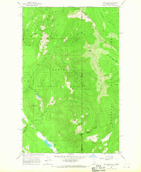
1965 Map of Line Point
USGS Topo · Published 1967About this map
Buckhorn Mtn and Buckhorn Mine sit at the northern edge of this high-country landscape, where the Idaho Montana state line meets the Boundary Co Lincoln Co division. The terrain is defined by a series of prominent peaks and ridgelines, including Keno Mountain, Goat Mountain, and Thunder Mtn, which split the drainage between the Kaniksu National Forest and Kootenai National Forest. A high Lookout Tower on Deer Ridge provided a vantage point for forest management during the mid-1960s.
Find a feature on this map
33 named features on this map. Tap any name to fly to it.
Don’t see what you’re looking for? This feature index may not catch every label — zoom into the map to look around manually.
Map Details
Editions of this 1965 Line Point Map
2 editions found
Other maps of this area

1911 · Priest Lake
USGS Topo · 1:250,000

1913 · Priest Lake
USGS Topo · 1:250,000

1957 · Kalispell
USGS Topo · 1:250,000

1958 · Sandpoint
USGS Topo · 1:250,000

1960 · Kalispell
USGS Topo · 1:250,000

1961 · Kalispell
USGS Topo · 1:250,000

1963 · Sandpoint
USGS Topo · 1:250,000

1963 · Mount Baldy
USGS Topo · 1:24,000

1963 · Northwest Peak
USGS Topo · 1:24,000
1963 · Newton Mountain
USGS Topo · 1:24,000