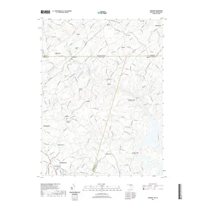
2019 Map of Lineboro
USGS Topo · Published 2019About this map
Gunpowder Falls and its various tributaries define the landscape along the Maryland-Pennsylvania border, where small settlements like Lineboro and Stiltz straddle the state line. This region, characterized by its rolling agricultural land and narrow valleys, contains several small community anchors including the Alesia Free Methodist Church Cem and the Millers United Methodist Church Cem. The mapping shows a persistent pattern of rural life, with legacy family names appearing on cemeteries such as Lazarus Cem and Stansbury Cem. To the south, the terrain descends toward the reservoirs of Baltimore County, with Beckleysville situated near the quiet inlets of the river system. The presence of features like Beecher Hill and Dug Hill Ridge provides a clear view of the Piedmont geography that shaped early transportation routes through Hampstead and Manchester.
Find a feature on this map
148 named features on this map. Tap any name to fly to it.
Don’t see what you’re looking for? This feature index may not catch every label — zoom into the map to look around manually.
Map Details
Editions of this 2019 Lineboro Map
This is the sole edition of this map. No revisions or reprints were ever made.
Other maps of this area

1900 · Parkton
USGS Topo · 1:62,500

1902 · Parkton
USGS Topo · 1:62,500

1905 · Westminster
USGS Topo · 1:62,500

1908 · York
USGS Topo · 1:62,500

1910 · York
USGS Topo · 1:62,500

1920 · Hanover
USGS Topo · 1:62,500

1922 · Hanover
USGS Topo · 1:62,500

1944 · New Freedom
USGS Topo · 1:31,680

1944 · Manchester
USGS Topo · 1:31,680

1944 · Hampstead
USGS Topo · 1:31,680