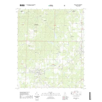
2021 Map of Lineville West
USGS Topo · Published 2021About this map
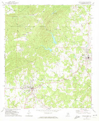
Ashland and the western outskirts of Lineville anchor this map of Clay County, Alabama, where the topography transitions from the high peaks of the Talladega National Forest into the creek-carved hills of the Piedmont. The Clay County Courthouse serves as the central landmark for the region, surrounded by a network of rural settlements like Pyriton, Highland, and Bowden Grove. The landscape is defined by the complex drainage systems of Talladega Creek and the multiple forks of Crooked Creek, which have historically dictated road patterns and settlement locations. Notable for genealogists, the map identifies numerous small burial grounds and places of worship, including the Macedonia Primitive Baptist Church Cem and Olive Branch Baptist Cem. Transportation is represented by the Ashland/Lineville Airport and a dense grid of county roads that connect isolated ridges like Sanduski Ridge to the more developed centers.
Find a feature on this map
131 named features on this map. Tap any name to fly to it.
Don’t see what you’re looking for? This feature index may not catch every label — zoom into the map to look around manually.
Map Details
Editions of this 2021 Lineville West Map
This is the sole edition of this map. No revisions or reprints were ever made.
Other maps of this area

1891 · Ashland
USGS Topo · 1:125,000

1953 · Atlanta
USGS Topo · 1:250,000

1957 · Atlanta
USGS Topo · 1:250,000

1958 · Atlanta
USGS Topo · 1:250,000
1969 · Clairmont Springs
USGS Topo · 1:24,000
1969 · Millerville
USGS Topo · 1:24,000

1969 · Gibsonville
USGS Topo · 1:24,000

1969 · Mellow Valley
USGS Topo · 1:24,000
1969 · Cheaha Mountain
USGS Topo · 1:24,000
1969 · Lineville West
USGS Topo · 1:24,000