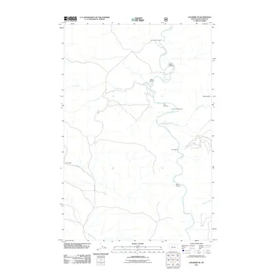
2011 Map of Lingshire NE
USGS Topo · Published 2011About this map
The Smith River carves a deep, winding course through this remote portion of Meagher County, serving as the primary geographic corridor for both water and access. The landscape is defined by its dramatic verticality, where tributary drainages like One Creek, Two Creek, and Tenderfoot Creek cut through the high terrain to join the main river. These natural pathways dictated the location of early seasonal sites and access points, evidenced by Cow Coulee Boat Camp, Two Creek Boat Camp, and Canyon Depth Boat Camp along the river's edge. Human activity is sparse and concentrated along established routes like Sky Ranch Rd and Lingshire Rd, which provide the only overland connection to more established settlements outside the canyon walls. Significant topographical landmarks such as Black Canyon, Dry Canyon, and Indiana Gulch further illustrate the complex network of breaks and drainages that characterize this Montana backcountry.
Find a feature on this map
17 named features on this map. Tap any name to fly to it.
Don’t see what you’re looking for? This feature index may not catch every label — zoom into the map to look around manually.
Map Details
Editions of this 2011 Lingshire NE Map
This is the sole edition of this map. No revisions or reprints were ever made.
Other maps of this area

1886 · Great Falls
USGS Topo · 1:250,000

1886 · Fort Logan
USGS Topo · 1:250,000

1948 · White Sulphur Springs
USGS Topo · 1:250,000

1954 · Great Falls
USGS Topo · 1:250,000

1957 · Great Falls
USGS Topo · 1:250,000

1958 · White Sulphur Springs
USGS Topo · 1:250,000

1961 · White Sulphur Springs
USGS Topo · 1:250,000

1965 · White Sulphur Springs
USGS Topo · 1:250,000

1966 · Lingshire
USGS Topo · 1:24,000

1966 · Lingshire NE
USGS Topo · 1:24,000