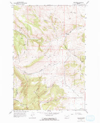
1966 Map of Lingshire
USGS Topo · Published 1970About this map
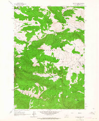
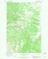
Helena National Forest dominates this mid-1960s landscape, where the tri-county borders of Meagher, Broadwater, and Lewis and Clark intersect. The small settlement of Lingshire sits along Rock Creek in the northeast, serving as a rare point of habitation in a terrain defined by steep drainages and mountain peaks. The geography is characterized by an extensive network of gulches, including the colorfully named Calamity Gulch, Antelope Gulch, and Moonshine Gulch, which feed into larger water systems like Middle Creek and East Fork Indian Creek. High-elevation landmarks such as Avalanche Butte and the adjacent Avalanche Slide rise in the southwest, while numerous springs, including Crystal Spring, provide water sources across the forest land. A network of jeep trails provides the primary means of navigation through the narrow corridors of Buffalo Canyon and the surrounding backcountry.
Find a feature on this map
22 named features on this map. Tap any name to fly to it.
Don’t see what you’re looking for? This feature index may not catch every label — zoom into the map to look around manually.
Map Details
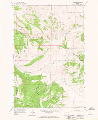
Editions of this 1966 Lingshire Map
2 editions found
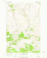
Other maps of this area

1886 · Fort Logan
USGS Topo · 1:250,000

1948 · White Sulphur Springs
USGS Topo · 1:250,000
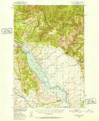
1950 · Canyon Ferry
USGS Topo · 1:62,500

1958 · White Sulphur Springs
USGS Topo · 1:250,000

1961 · White Sulphur Springs
USGS Topo · 1:250,000
1962 · B K Ranch
USGS Topo · 1:24,000
1962 · Snedaker Basin
USGS Topo · 1:24,000

1965 · White Sulphur Springs
USGS Topo · 1:250,000
1966 · Whites City
USGS Topo · 1:24,000

1966 · Watson
USGS Topo · 1:24,000