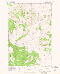
1966 Map of Lingshire
USGS Topo · Published 1970About this map
Lingshire sits at the northern end of the Dry Range in a landscape defined by sharp elevation changes and high-altitude water sources. This 1966 survey, based on 1965 aerial photography, captures the intricate network of drainages feeding into Rock Creek and Buffalo Creek. The southern portion of the map is dominated by the Helena National Forest, where steep terrain includes named features like Moonsine Gulch, Rubison Gulch, and the prominent Avalanche Butte.
Find a feature on this map
21 named features on this map. Tap any name to fly to it.
Don’t see what you’re looking for? This feature index may not catch every label — zoom into the map to look around manually.
Map Details
Editions of this 1966 Lingshire Map
2 editions found
Other maps of this area

1886 · Fort Logan
USGS Topo · 1:250,000

1948 · White Sulphur Springs
USGS Topo · 1:250,000

1950 · Canyon Ferry
USGS Topo · 1:62,500

1958 · White Sulphur Springs
USGS Topo · 1:250,000

1961 · White Sulphur Springs
USGS Topo · 1:250,000

1962 · B K Ranch
USGS Topo · 1:24,000

1962 · Snedaker Basin
USGS Topo · 1:24,000

1965 · White Sulphur Springs
USGS Topo · 1:250,000

1966 · Lingshire
USGS Topo · 1:24,000

1966 · Whites City
USGS Topo · 1:24,000