
1962 Map of Snedaker Basin
USGS Topo · Published 1964About this map
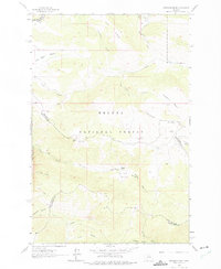
Helena National Forest dominates this topographic study, where the high ridges of the Snedaker Divide separate the drainages of the Big Belt Mountains. This area, spanning the borders of Meagher, Lewis and Clark, and Broadwater counties, shows a landscape defined by seasonal water and high-elevation basins. Sunshine Ranch sits as a notable point of human activity near the center of the sheet, surrounded by the dramatic topography of Sunshine Basin and Bluegill Canyon.
Find a feature on this map
22 named features on this map. Tap any name to fly to it.
Don’t see what you’re looking for? This feature index may not catch every label — zoom into the map to look around manually.
Map Details
Editions of this 1962 Snedaker Basin Map
2 editions found
Other maps of this area

1886 · Fort Logan
USGS Topo · 1:250,000

1948 · White Sulphur Springs
USGS Topo · 1:250,000

1950 · Canyon Ferry
USGS Topo · 1:62,500

1958 · White Sulphur Springs
USGS Topo · 1:250,000

1961 · White Sulphur Springs
USGS Topo · 1:250,000

1962 · Hogback Mountain
USGS Topo · 1:24,000

1962 · B K Ranch
USGS Topo · 1:24,000
1962 · Middle Creek Lake
USGS Topo · 1:24,000

1965 · White Sulphur Springs
USGS Topo · 1:250,000

1966 · Lingshire
USGS Topo · 1:24,000
Featured Places
- Vigilante Overlook, MT
- Lewis and Clark County, MT
- Meagher County, MT
- Broadwater County, MT
- United States