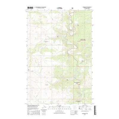
2017 Map of Lingshire NE
USGS Topo · Published 2017About this map
The Smith River meanders through the heart of this Meagher County landscape, carving a deep path between the Lewis & Clark National Forest and the Helena National Forest. This remote section of Montana is defined by its dramatic drainage systems, where seasonal and perennial streams like Tenderfoot Cr and Blacktail Cr feed into the river valley. The topography is marked by named geographic features such as Black Canyon, Cow Coulee, and Mud Gulch, illustrating the complex erosional patterns of the Smith River basin. A handful of local routes, including Two Creeks Rd and Sky Ranch Rd, provide limited access to the high plateaus and creek beds. The map provides a clear view of the public land boundaries and the intricate network of tributaries like One Cr and Two Cr that shape this wilderness area.
Find a feature on this map
23 named features on this map. Tap any name to fly to it.
Don’t see what you’re looking for? This feature index may not catch every label — zoom into the map to look around manually.
Map Details
Editions of this 2017 Lingshire NE Map
This is the sole edition of this map. No revisions or reprints were ever made.
Other maps of this area

1886 · Great Falls
USGS Topo · 1:250,000

1886 · Fort Logan
USGS Topo · 1:250,000

1948 · White Sulphur Springs
USGS Topo · 1:250,000

1954 · Great Falls
USGS Topo · 1:250,000

1957 · Great Falls
USGS Topo · 1:250,000

1958 · White Sulphur Springs
USGS Topo · 1:250,000

1961 · White Sulphur Springs
USGS Topo · 1:250,000

1965 · White Sulphur Springs
USGS Topo · 1:250,000

1966 · Lingshire
USGS Topo · 1:24,000

1966 · Lingshire NE
USGS Topo · 1:24,000