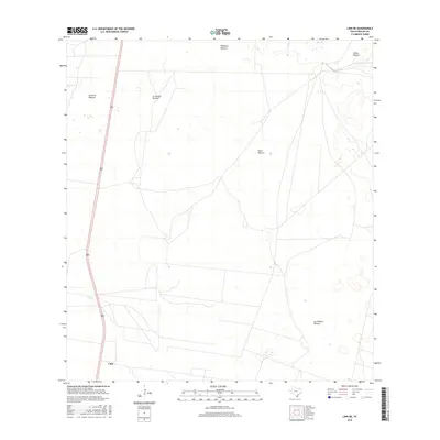
2016 Map of Linn NE
USGS Topo · Published 2016About this map
Large grazing tracts and pasture lands define the rural landscape of this Hidalgo County region, centered near the settlement of Linn. The topography is dominated by extensive fenced divisions, including Santa Fe Pasture and La Copita Pasture, which speak to the area's long-standing ranching tradition. The infrastructure is characterized by the linear path of highway 281, providing a vital north-south link through the otherwise open country. Historically significant named land blocks such as Padrones Pasture, Mula Pasture, and Los Machos Pasture suggest a heritage of large-scale land grants and agricultural heritage. The sparse distribution of structures away from the main road corridor underscores the transition from the small community at Linn into the expansive, arid grasslands of the South Texas brush country.
Find a feature on this map
8 named features on this map. Tap any name to fly to it.
Don’t see what you’re looking for? This feature index may not catch every label — zoom into the map to look around manually.
Map Details
Editions of this 2016 Linn NE Map
This is the sole edition of this map. No revisions or reprints were ever made.
Other maps of this area

1922 · La Sal Vieja
USGS Topo · 1:62,500

1923 · Armstrong
USGS Topo · 1:62,500

1939 · Linn
USGS Topo · 1:62,500

1949 · Mc Allen
USGS Topo · 1:250,000

1953 · Brownsville
USGS Topo · 1:250,000

1954 · McAllen
USGS Topo · 1:250,000

1956 · Julian
USGS Topo · 1:24,000

1956 · Andrea Ranch
USGS Topo · 1:24,000

1956 · La Sal Vieja
USGS Topo · 1:24,000

1956 · La Sal Vieja
USGS Topo · 1:62,500