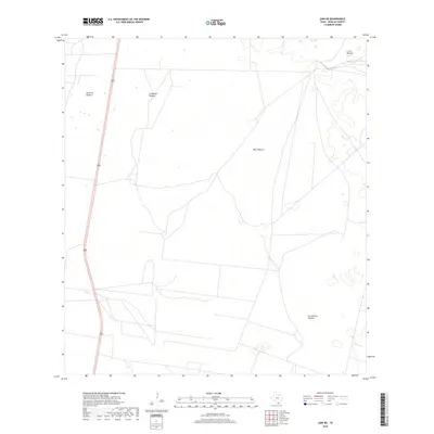
2019 Map of Linn NE
USGS Topo · Published 2019About this map
Large livestock grazing lands define this landscape in northern Hidalgo County, where naming conventions reflect the region's ranching heritage. Large tracts such as Santa Fe Pasture and La Copita Pasture dominate the western half of the quadrangle, while Julian Pasture and Los Machos Pasture stretch across the east. The terrain is marked by ephemeral water features and depressional wetlands, typical of the brush country in this part of South Texas. Bisecting the western edge is Highway 281, providing the primary transit corridor through an otherwise open expanse of Mula Pasture. The map's sparse labels reveal a land primarily dedicated to large-scale ranching operations rather than dense residential development, preserving the historical character of the Texas borderlands' rural interior.
Find a feature on this map
6 named features on this map. Tap any name to fly to it.
Don’t see what you’re looking for? This feature index may not catch every label — zoom into the map to look around manually.
Map Details
Editions of this 2019 Linn NE Map
This is the sole edition of this map. No revisions or reprints were ever made.
Other maps of this area

1922 · La Sal Vieja
USGS Topo · 1:62,500

1923 · Armstrong
USGS Topo · 1:62,500

1939 · Linn
USGS Topo · 1:62,500

1949 · Mc Allen
USGS Topo · 1:250,000

1953 · Brownsville
USGS Topo · 1:250,000

1954 · McAllen
USGS Topo · 1:250,000

1956 · Julian
USGS Topo · 1:24,000

1956 · Andrea Ranch
USGS Topo · 1:24,000

1956 · La Sal Vieja
USGS Topo · 1:24,000

1956 · La Sal Vieja
USGS Topo · 1:62,500