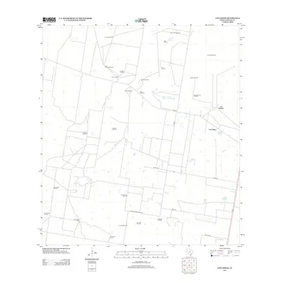
2012 Map of Linn Siding
USGS Topo · Published 2012About this map
Windmills and ranching heritage define this landscape in Hidalgo County, where water management is central to the local economy. The naming of numerous water-drawing sites such as Agua Salado Windmill, Santo Domingo Windmill, and La Rosita Windmill reflects the critical importance of groundwater for the various ranch holdings scattered across the terrain. Prominent properties like Tijerina Ranch, Santa Anita Ranch, and Casa Blanca Ranch suggest a history of large family-held land parcels, many centered around these essential water sources.
Find a feature on this map
32 named features on this map. Tap any name to fly to it.
Don’t see what you’re looking for? This feature index may not catch every label — zoom into the map to look around manually.
Map Details
Editions of this 2012 Linn Siding Map
This is the sole edition of this map. No revisions or reprints were ever made.
Other maps of this area

1939 · Linn
USGS Topo · 1:62,500

1939 · La Reforma
USGS Topo · 1:62,500

1940 · Monte Christo
USGS Topo · 1:62,500

1949 · Mc Allen
USGS Topo · 1:250,000

1954 · McAllen
USGS Topo · 1:250,000

1957 · Mc Allen
USGS Topo · 1:250,000

1962 · McAllen
USGS Topo · 1:250,000

1963 · Monte Christo
USGS Topo · 1:24,000
1963 · Hargill
USGS Topo · 1:24,000

1963 · Linn NW
USGS Topo · 1:24,000