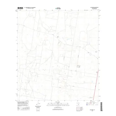
2016 Map of Linn Siding
USGS Topo · Published 2016About this map
Linn Siding and the neighboring community of Linn anchor this South Texas landscape in Hidalgo County, representing a region defined by its rural road network and water management. The terrain is marked by numerous small depressions and the S Reservoir, which are vital features in this semi-arid environment. Family history and local heritage are centered at the Santa Anita Cem, located just off FM 1017. The map illustrates a transition between agricultural land use and natural brushland, with a grid of local roads like Miller Rd and Red Gate Rd providing access to remote ranching properties and small homesteads. This 2016 survey provides a precise view of the infrastructure and land divisions that persist in this part of the Rio Grande Valley hinterlands.
Find a feature on this map
12 named features on this map. Tap any name to fly to it.
Don’t see what you’re looking for? This feature index may not catch every label — zoom into the map to look around manually.
Map Details
Editions of this 2016 Linn Siding Map
This is the sole edition of this map. No revisions or reprints were ever made.
Other maps of this area

1939 · Linn
USGS Topo · 1:62,500

1939 · La Reforma
USGS Topo · 1:62,500

1940 · Monte Christo
USGS Topo · 1:62,500

1949 · Mc Allen
USGS Topo · 1:250,000

1954 · McAllen
USGS Topo · 1:250,000

1957 · Mc Allen
USGS Topo · 1:250,000

1962 · McAllen
USGS Topo · 1:250,000

1963 · Monte Christo
USGS Topo · 1:24,000
1963 · Hargill
USGS Topo · 1:24,000

1963 · Linn NW
USGS Topo · 1:24,000