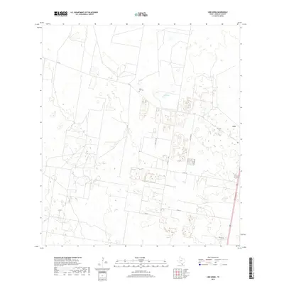
2019 Map of Linn Siding
USGS Topo · Published 2019About this map
Santa Anita Cem serves as a quiet landmark in this South Texas landscape, situated near FM 1017 in northern Hidalgo County. This 2019 survey documents a region defined by a mix of agricultural plots, large ranch boundaries, and the evolving transportation corridor along the eastern edge. The settlement of Linn and the historic marker of Linn Siding reflect the area’s longstanding connection to regional rail and road networks, while water management is highlighted by the South Reservoir. Local infrastructure like Shelly Lori Rd, Floral Rd, and Red Gate Rd segment the terrain into distinct rural tracts, illustrating the balance between open brushland and residential development typical of this part of the Rio Grande Valley hinterlands.
Find a feature on this map
12 named features on this map. Tap any name to fly to it.
Don’t see what you’re looking for? This feature index may not catch every label — zoom into the map to look around manually.
Map Details
Editions of this 2019 Linn Siding Map
This is the sole edition of this map. No revisions or reprints were ever made.
Other maps of this area

1939 · Linn
USGS Topo · 1:62,500

1939 · La Reforma
USGS Topo · 1:62,500

1940 · Monte Christo
USGS Topo · 1:62,500

1949 · Mc Allen
USGS Topo · 1:250,000

1954 · McAllen
USGS Topo · 1:250,000

1957 · Mc Allen
USGS Topo · 1:250,000

1962 · McAllen
USGS Topo · 1:250,000

1963 · Monte Christo
USGS Topo · 1:24,000
1963 · Hargill
USGS Topo · 1:24,000

1963 · Linn NW
USGS Topo · 1:24,000