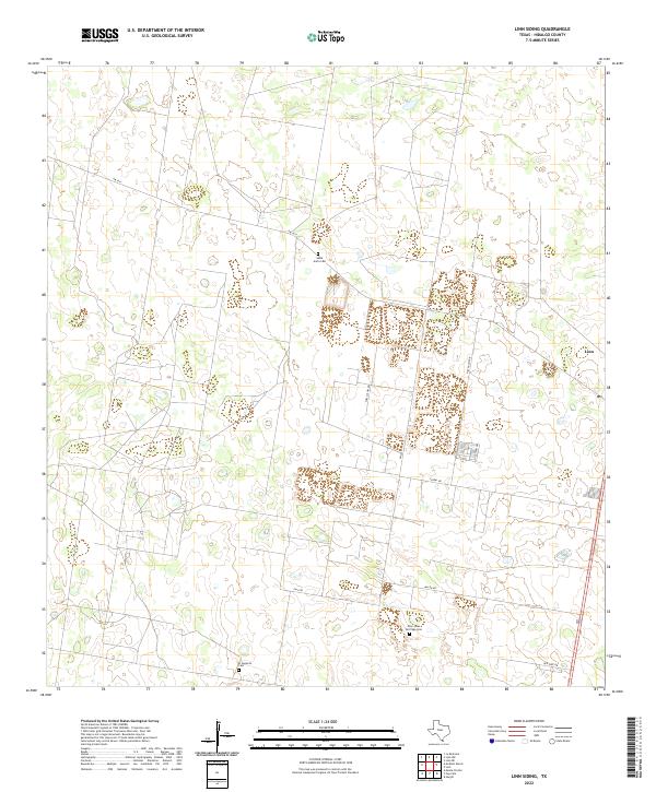
2022 Map of Linn Siding
USGS Topo · Published 2022About this map
Santa Anita Cem and other small burial sites dot the landscape of the Rio Grande Valley in this modern survey of northern Hidalgo County. This region is defined by a lattice of agricultural and residential corridors such as Fm 1017 and Fm 3250, which connect the settlement of Linn to the surrounding ranchlands. The map reveals the intricate parceling of land typical of this part of South Texas, where family-named roads like Shelly Lori Rd and rural residential developments like Lazy Palms Dr have emerged from formerly open scrub and cattle country. Genealogists will find particular value in the identification of several community cemeteries, including Nino Jesus De Praga Cem and El Desierto Cem, which serve as quiet landmarks of the area's deep-rooted cultural heritage and historical settlement patterns.
Find a feature on this map
12 named features on this map. Tap any name to fly to it.
Don’t see what you’re looking for? This feature index may not catch every label — zoom into the map to look around manually.
Map Details
Editions of this 2022 Linn Siding Map
This is the sole edition of this map. No revisions or reprints were ever made.
Other maps of this area

1939 · Linn
USGS Topo · 1:62,500

1939 · La Reforma
USGS Topo · 1:62,500

1940 · Monte Christo
USGS Topo · 1:62,500

1949 · Mc Allen
USGS Topo · 1:250,000

1954 · McAllen
USGS Topo · 1:250,000

1957 · Mc Allen
USGS Topo · 1:250,000

1962 · McAllen
USGS Topo · 1:250,000

1963 · Monte Christo
USGS Topo · 1:24,000
1963 · Hargill
USGS Topo · 1:24,000

1963 · Linn NW
USGS Topo · 1:24,000