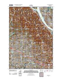
2011 Map of Linnton
USGS Topo · Published 2011About this map
The Willamette River and Multnomah Channel define the eastern edge of this landscape, where industrial zones like Rivergate and the Saint Johns Bridge meet the residential slopes of the Tualatin Mountains. This area serves as a critical junction between the dense urban grid of Portland and the suburban expansion into Beaverton and Aloha. A significant concentration of cemeteries, including the Skyline Memorial Gardens and the German Presbyterian Cemetery, underscores the area's role as a long-standing community hub for the West Hills and Tualatin Valley.
Find a feature on this map
97 named features on this map. Tap any name to fly to it.
Don’t see what you’re looking for? This feature index may not catch every label — zoom into the map to look around manually.
Map Details
Editions of this 2011 Linnton Map
This is the sole edition of this map. No revisions or reprints were ever made.
Other maps of this area

1897 · Portland
USGS Topo · 1:62,500

1905 · Portland
USGS Topo · 1:62,500

1914 · Oregon City
USGS Topo · 1:62,500

1915 · Hillsboro
USGS Topo · 1:62,500

1916 · Tualatin
USGS Topo · 1:62,500

1918 · Hillsboro
USGS Topo · 1:62,500

1939 · Oregon City
USGS Topo · 1:62,500

1939 · Tualatin
USGS Topo · 1:62,500

1940 · Tualatin
USGS Topo · 1:62,500

1940 · Hillsboro
USGS Topo · 1:62,500