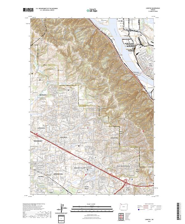
2024 Map of Linnton
USGS Topo · Published 2024About this map
The Tualatin Mountains form a significant topographic divide on this map, separating the industrial corridors along the Willamette River from the suburban expansion in the Tualatin Valley. On the eastern slopes, the riverside communities of Linnton, Whitwood Court, and Saint Johns mark the historical intersection of rail and river commerce near Doane Point. To the west, the landscape transitions into a dense network of residential developments including Bethany, Oak Hills, and Cedar Mill.
Find a feature on this map
67 named features on this map. Tap any name to fly to it.
Don’t see what you’re looking for? This feature index may not catch every label — zoom into the map to look around manually.
Map Details
Editions of this 2024 Linnton Map
This is the sole edition of this map. No revisions or reprints were ever made.
Other maps of this area

1897 · Portland
USGS Topo · 1:62,500

1905 · Portland
USGS Topo · 1:62,500

1914 · Oregon City
USGS Topo · 1:62,500

1915 · Hillsboro
USGS Topo · 1:62,500

1916 · Tualatin
USGS Topo · 1:62,500

1918 · Hillsboro
USGS Topo · 1:62,500

1939 · Oregon City
USGS Topo · 1:62,500

1939 · Tualatin
USGS Topo · 1:62,500

1940 · Tualatin
USGS Topo · 1:62,500

1940 · Hillsboro
USGS Topo · 1:62,500