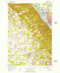
1954 Map of Linnton
USGS Topo · Published 1957About this map
The Tualatin Mountains rise steeply between the Willamette River and the agricultural plains of Washington County in this mid-1950s survey. The industrial waterfront of Linnton and St Johns is well-defined by extensive rail infrastructure, including the Spokane Portland and Seattle Ry and the Union Pacific RR. To the west, the landscape transitions into a series of developing mid-century communities and historical crossroads. Features like Cedar Mill, Sunset Valley, and the newly established Marlene Village illustrate the post-war suburban expansion moving toward Beaverton. Along the ridge of the hills, Skyline Blvd offers a winding path through the timbered slopes, passing the Skyline Memorial Gardens and Cornelius Pass. The map also captures several local education landmarks, such as the McKinley School and the already noted Rock Creek School (Aband), reflecting the shifting population centers of the era.
Find a feature on this map
60 named features on this map. Tap any name to fly to it.
Don’t see what you’re looking for? This feature index may not catch every label — zoom into the map to look around manually.
Map Details
Editions of this 1954 Linnton Map
This is the sole edition of this map. No revisions or reprints were ever made.
Other maps of this area

1897 · Portland
USGS Topo · 1:62,500

1905 · Portland
USGS Topo · 1:62,500

1914 · Oregon City
USGS Topo · 1:62,500

1915 · Hillsboro
USGS Topo · 1:62,500

1916 · Tualatin
USGS Topo · 1:62,500

1918 · Hillsboro
USGS Topo · 1:62,500

1939 · Oregon City
USGS Topo · 1:62,500

1939 · Tualatin
USGS Topo · 1:62,500

1940 · Tualatin
USGS Topo · 1:62,500

1940 · Hillsboro
USGS Topo · 1:62,500