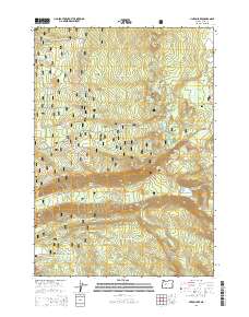
2014 Map of Linton Lake
USGS Topo · Published 2014About this map
The Cascade Range divides the high elevations of the Willamette National Forest in this 2014 survey. This portion of the mountains is defined by a high density of alpine water features and dramatic vertical drops, including Linton Lake and the nearby Linton Falls. The transportation network relies on a mix of modern forest development roads and the historic route of the Old Mc Kenzie Hwy, which winds through the center of the sheet near Alder Springs.
Find a feature on this map
52 named features on this map. Tap any name to fly to it.
Don’t see what you’re looking for? This feature index may not catch every label — zoom into the map to look around manually.
Map Details
Editions of this 2014 Linton Lake Map
This is the sole edition of this map. No revisions or reprints were ever made.
Other maps of this area

1929 · Three Sisters
USGS Topo · 1:125,000

1932 · Three Sisters
USGS Topo · 1:125,000

1934 · Mc Kenzie Bridge
USGS Topo · 1:96,000

1940 · Mc Kenzie Bridge
USGS Topo · 1:125,000

1953 · Salem
USGS Topo · 1:250,000

1954 · Salem
USGS Topo · 1:250,000

1955 · Echo Mountain
USGS Topo · 1:62,500

1955 · Mc Kenzie Bridge
USGS Topo · 1:62,500

1955 · Bend
USGS Topo · 1:250,000

1957 · Bend
USGS Topo · 1:250,000