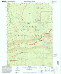
1997 Map of Linton Lake
USGS Topo · Published 2001About this map
High volcanic plateaus and alpine wilderness dominate this landscape in the Central Cascades as it appeared at the close of the twentieth century. The terrain is defined by the legacy of geologic activity, featuring extensive lava flows and high-elevation basins. Knobs Sheep Camp remains a notable landmark in the northern section of the quadrangle, hinting at the area's history of seasonal grazing before the expansion of modern wilderness management. The map reflects a period of transition where early forest use markers like sheep camps persisted alongside modern recreational and conservation designations.
Find a feature on this map
1 named feature on this map. Tap any name to fly to it.
Don’t see what you’re looking for? This feature index may not catch every label — zoom into the map to look around manually.
Map Details
Editions of this 1997 Linton Lake Map
This is the sole edition of this map. No revisions or reprints were ever made.
Other maps of this area

1929 · Three Sisters
USGS Topo · 1:125,000

1932 · Three Sisters
USGS Topo · 1:125,000

1934 · Mc Kenzie Bridge
USGS Topo · 1:96,000

1940 · Mc Kenzie Bridge
USGS Topo · 1:125,000

1953 · Salem
USGS Topo · 1:250,000

1954 · Salem
USGS Topo · 1:250,000

1955 · Echo Mountain
USGS Topo · 1:62,500

1955 · Mc Kenzie Bridge
USGS Topo · 1:62,500

1955 · Bend
USGS Topo · 1:250,000

1957 · Bend
USGS Topo · 1:250,000