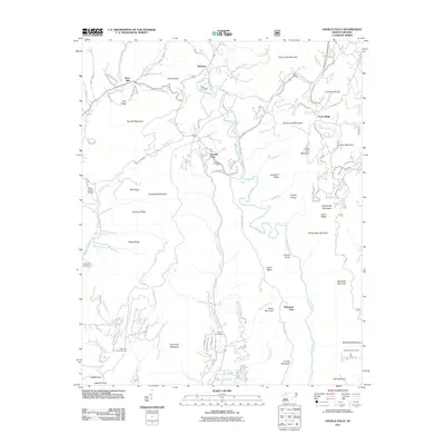
2011 Map of Linville Falls
USGS Topo · Published 2011About this map
Linville Falls and the dramatic drop of the Linville River serve as the centerpiece of this topographic study, where the waterway carves through the deep Linville Gorge. This high-elevation terrain is defined by its verticality, from the summit of Hawksbill Mountain to the depths of the gorge below Wisemans View. Small settlements like Altamont and Jonas Ridge are scattered along the ridgelines and valley floors, connected by mountain roads such as Gingercake Rd and Mortimer Rd. For genealogists and local historians, several family-named landmarks and burial sites are documented, including the Wise Cemetery, Wilson Cemetery, and McKinney Cemetery. The landscape transitions from the residential clusters of Three Mile and the Avery County Airport in the west to the protected wilderness around The Chimneys and Table Rock Mountain in the east.
Find a feature on this map
96 named features on this map. Tap any name to fly to it.
Don’t see what you’re looking for? This feature index may not catch every label — zoom into the map to look around manually.
Map Details
Editions of this 2011 Linville Falls Map
This is the sole edition of this map. No revisions or reprints were ever made.
Other maps of this area

1891 · Roan Mountain
USGS Topo · 1:125,000

1893 · Cranberry
USGS Topo · 1:125,000

1894 · Roan Mountain
USGS Topo · 1:125,000

1895 · Cranberry
USGS Topo · 1:125,000

1899 · Cranberry
USGS Topo · 1:125,000

1900 · Mount Mitchell
USGS Topo · 1:125,000

1902 · Cranberry
USGS Topo · 1:125,000

1902 · Mount Mitchell
USGS Topo · 1:125,000

1904 · Roan Mountain
USGS Topo · 1:125,000

1905 · Morganton
USGS Topo · 1:125,000