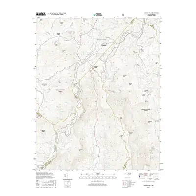
2016 Map of Linville Falls
USGS Topo · Published 2016About this map
Linville Gorge dominates the eastern landscape of this 2016 survey, where the Linville River carves deeply through the terrain. The map captures the significant hydrological break at the Tennessee Valley Divide, separating the headwaters that feed the Atlantic from those flowing toward the Gulf. Settlement patterns cluster around the Blue Ridge Parkway and state routes, including the communities of Altamont, Jonas Ridge, and Linville Falls.
Find a feature on this map
78 named features on this map. Tap any name to fly to it.
Don’t see what you’re looking for? This feature index may not catch every label — zoom into the map to look around manually.
Map Details
Editions of this 2016 Linville Falls Map
This is the sole edition of this map. No revisions or reprints were ever made.
Other maps of this area

1891 · Roan Mountain
USGS Topo · 1:125,000

1893 · Cranberry
USGS Topo · 1:125,000

1894 · Roan Mountain
USGS Topo · 1:125,000

1895 · Cranberry
USGS Topo · 1:125,000

1899 · Cranberry
USGS Topo · 1:125,000

1900 · Mount Mitchell
USGS Topo · 1:125,000

1902 · Cranberry
USGS Topo · 1:125,000

1902 · Mount Mitchell
USGS Topo · 1:125,000

1904 · Roan Mountain
USGS Topo · 1:125,000

1905 · Morganton
USGS Topo · 1:125,000