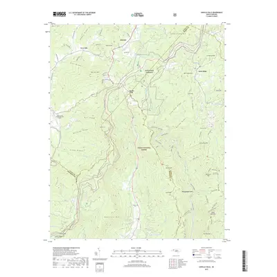
2019 Map of Linville Falls
USGS Topo · Published 2019About this map
Linville Falls serves as a central hub for this high-elevation landscape, where the Linville River carves deeply into the Linville Gorge. The topographic record shows the intersection of four counties—Avery, Burke, Mitchell, and McDowell—marked by traditional mountain settlements like Altamont and Three Mile. Transportation is dominated by the winding path of the Blue Ridge Parkway, which provides access to notable overlooks such as Wisemans View and trailheads for the Erwins View Trail. Local heritage is preserved in sites like Wise Cem and Wilson Cem, while the rugged eastern terrain is defined by prominent peaks including Table Rock Mtn and Hawksbill Mtn. The Pisgah National Forest encompasses much of the area, protecting a network of ridges such as Jonas Ridge and Dividing Ridge that separate the river drainage from smaller peaks like The Chimneys.
Find a feature on this map
91 named features on this map. Tap any name to fly to it.
Don’t see what you’re looking for? This feature index may not catch every label — zoom into the map to look around manually.
Map Details
Editions of this 2019 Linville Falls Map
This is the sole edition of this map. No revisions or reprints were ever made.
Other maps of this area

1891 · Roan Mountain
USGS Topo · 1:125,000

1893 · Cranberry
USGS Topo · 1:125,000

1894 · Roan Mountain
USGS Topo · 1:125,000

1895 · Cranberry
USGS Topo · 1:125,000

1899 · Cranberry
USGS Topo · 1:125,000

1900 · Mount Mitchell
USGS Topo · 1:125,000

1902 · Cranberry
USGS Topo · 1:125,000

1902 · Mount Mitchell
USGS Topo · 1:125,000

1904 · Roan Mountain
USGS Topo · 1:125,000

1905 · Morganton
USGS Topo · 1:125,000