
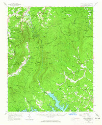
1956 Map of Linville Falls
USGS Topo · Published 1962About this map
The dramatic topography of the Linville Gorge dominates this mid-century survey, where the Linville River carves through the landscape between the heights of Sitting Bear Mtn and Hawksbill Mtn. The region is defined by its recreation and conservation history, featuring the Pisgah National Forest, Linville Caverns, and the Tablerock State Fish Hatchery. Transport networks like the Blue Ridge Parkway and the Kistler Memorial Highway provide access to these remote elevations.
Find a feature on this map
107 named features on this map. Tap any name to fly to it.
Don’t see what you’re looking for? This feature index may not catch every label — zoom into the map to look around manually.
Map Details
Editions of this 1956 Linville Falls Map
2 editions found
Other maps of this area

1891 · Roan Mountain
USGS Topo · 1:125,000

1893 · Cranberry
USGS Topo · 1:125,000

1894 · Roan Mountain
USGS Topo · 1:125,000

1895 · Cranberry
USGS Topo · 1:125,000

1899 · Cranberry
USGS Topo · 1:125,000

1900 · Mount Mitchell
USGS Topo · 1:125,000

1902 · Cranberry
USGS Topo · 1:125,000

1902 · Mount Mitchell
USGS Topo · 1:125,000

1904 · Roan Mountain
USGS Topo · 1:125,000

1905 · Morganton
USGS Topo · 1:125,000