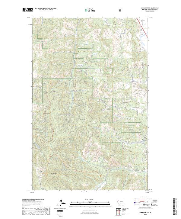
2024 Map of Lion Mountain
USGS Topo · Published 2024About this map
Lakeside sits at the edge of the Flathead Valley, serving as a gateway to the mountainous terrain of the Flathead National Forest. This 2024 edition shows a landscape defined by significant elevations, including Lion Mtn, Baldy Mtn, and Blacktail Mtn. A network of forest roads and trails, such as Patrick Creek Rd and the Foys To Blacktail Trl, winds through the creek drainages of Stoner Creek, Bierney Creek, and Cramer Creek.
Find a feature on this map
50 named features on this map. Tap any name to fly to it.
Don’t see what you’re looking for? This feature index may not catch every label — zoom into the map to look around manually.
Map Details
Editions of this 2024 Lion Mountain Map
This is the sole edition of this map. No revisions or reprints were ever made.
Other maps of this area

1920 · Flathead Lake
USGS Topo · 1:125,000

1943 · Kalispell
USGS Topo · 1:125,000

1956 · Wallace
USGS Topo · 1:250,000

1957 · Kalispell
USGS Topo · 1:250,000

1960 · Kalispell
USGS Topo · 1:250,000

1960 · Wallace
USGS Topo · 1:250,000

1961 · Kalispell
USGS Topo · 1:250,000

1962 · Kila
USGS Topo · 1:24,000

1962 · Blue Grass Ridge
USGS Topo · 1:24,000

1962 · Lion Mountain
USGS Topo · 1:24,000