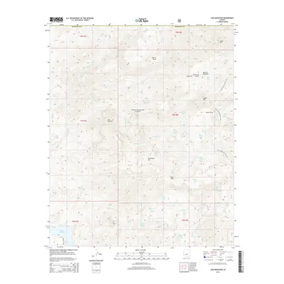
2014 Map of Lion Mountain
USGS Topo · Published 2014About this map
Tonto National Forest land defines this portion of the Mazatzal Mountains in Maricopa County, characterized by a complex network of seasonal springs and named canyons. The high-elevation terrain features prominent landmarks such as Lion Mountain and Saddle Mtn, with the Arizona National Scenic Trail traversing the eastern ridges near Potato Patch. This 2014 survey illustrates the intricate hydrography of the high desert, documenting numerous water sources like Dripping Spring, Cholla Spring, and Squaw Flat Spring. Human-made water management is also evident through the presence of Sparks Tank and Brunson Tank, which support the remote landscape. The map provides a clear picture of the natural drainages including Sheep Cr and Copper Camp Cr as they cut through the high ridges of Cypress Ridge and Black Ridge.
Find a feature on this map
55 named features on this map. Tap any name to fly to it.
Don’t see what you’re looking for? This feature index may not catch every label — zoom into the map to look around manually.
Map Details
Editions of this 2014 Lion Mountain Map
This is the sole edition of this map. No revisions or reprints were ever made.
Other maps of this area

1887 · Verde
USGS Topo · 1:250,000

1892 · Verde
USGS Topo · 1:250,000

1907 · Roosevelt
USGS Topo · 1:125,000

1909 · Four Peaks
USGS Topo · 1:125,000

1912 · Roosevelt
USGS Topo · 1:125,000

1929 · Turret Peak
USGS Topo · 1:125,000

1930 · Cave Creek
USGS Topo · 1:125,000

1933 · Turret Peak
USGS Topo · 1:125,000

1936 · Payson
USGS Topo · 1:48,000

1939 · Cave Creek
USGS Topo · 1:125,000