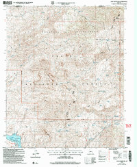
2004 Map of Lion Mountain
USGS Topo · Published 2006About this map
Mazatzal Mountains and the high desert of the Tonto National Forest dominate this terrain, where water sources like Mormon Grove Spring and Chalk Spring supported early livestock operations and prospectors. Evidence of the region’s mineral history is found at the Story Mine and several scattered prospects. To the south, the Verde River feeds the Bartlett Reservoir, which created the popular recreational area at Bartlett Flats and Cat Bay. This survey captures a landscape defined by sharp elevation changes, from the heights of Lion Mountain and Saddle Mountain down to the drainage of Sheep Creek. The حضور of the S B Cabin and the former settlement at Sears point to the remote habitations that once dotted this Maricopa and Yavapai County boundary line.
Find a feature on this map
68 named features on this map. Tap any name to fly to it.
Don’t see what you’re looking for? This feature index may not catch every label — zoom into the map to look around manually.
Map Details
Editions of this 2004 Lion Mountain Map
This is the sole edition of this map. No revisions or reprints were ever made.
Other maps of this area

1887 · Verde
USGS Topo · 1:250,000

1892 · Verde
USGS Topo · 1:250,000

1907 · Roosevelt
USGS Topo · 1:125,000

1909 · Four Peaks
USGS Topo · 1:125,000

1912 · Roosevelt
USGS Topo · 1:125,000

1929 · Turret Peak
USGS Topo · 1:125,000

1930 · Cave Creek
USGS Topo · 1:125,000

1933 · Turret Peak
USGS Topo · 1:125,000

1936 · Payson
USGS Topo · 1:48,000

1939 · Cave Creek
USGS Topo · 1:125,000