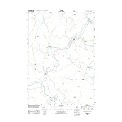
2012 Map of Lisbon
USGS Topo · Published 2012About this map
The Ammonoosuc River and its tributary, the Wild Ammonoosuc River, carve a central path through this part of Grafton County, anchoring the primary settlements of Lisbon and Bath. The landscape is defined by a network of upland ridges and valleys, featuring prominent landmarks like Moulton Hill, Babbit Hill, and Green Mountain. This 2012 survey captures the enduring rural character of the region, where historic hamlets such as Swiftwater, Ireland, and Savageville remain connected by ancient routes like Rabbit Path Rd. For genealogists and local historians, the map is a significant record of the area's burial grounds, including the Moulton Hill Cem and Pettyboro District Cem. Infrastructure such as the Salmon Hole Bridge and Swiftwater Bridge highlights the long-standing importance of river crossings in the local transport network.
Find a feature on this map
126 named features on this map. Tap any name to fly to it.
Don’t see what you’re looking for? This feature index may not catch every label — zoom into the map to look around manually.
Map Details
Editions of this 2012 Lisbon Map
This is the sole edition of this map. No revisions or reprints were ever made.
Other maps of this area

1929 · Moosilauke
USGS Topo · 1:62,500

1931 · Littleton
USGS Topo · 1:62,500

1931 · Woodsville
USGS Topo · 1:48,000

1932 · Littleton
USGS Topo · 1:48,000

1932 · Moosilauke
USGS Topo · 1:62,500

1935 · Woodsville
USGS Topo · 1:62,500

1935 · Littleton
USGS Topo · 1:62,500

1938 · St. Johnsbury
USGS Topo · 1:48,000

1941 · Woodsville
USGS Topo · 1:62,500

1943 · St. Johnsbury
USGS Topo · 1:62,500