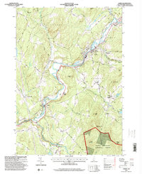
1995 Map of Lisbon
USGS Topo · Published 2000About this map
Ammonoosuc River frontage and the rugged hills of Grafton County define this landscape as it appeared in the mid-1990s. The settlement of Lisbon serves as a central hub, while smaller communities like Savageville and Pettyboro are tucked into the valleys. The map reveals a land defined by its elevation and history, featuring several prominent peaks such as Moulton Hill, Hunt Mountain, and Mount Hope.
Find a feature on this map
67 named features on this map. Tap any name to fly to it.
Don’t see what you’re looking for? This feature index may not catch every label — zoom into the map to look around manually.
Map Details
Editions of this 1995 Lisbon Map
This is the sole edition of this map. No revisions or reprints were ever made.
Other maps of this area

1929 · Moosilauke
USGS Topo · 1:62,500

1931 · Littleton
USGS Topo · 1:62,500

1931 · Woodsville
USGS Topo · 1:48,000

1932 · Littleton
USGS Topo · 1:48,000

1932 · Moosilauke
USGS Topo · 1:62,500

1935 · Woodsville
USGS Topo · 1:62,500

1935 · Littleton
USGS Topo · 1:62,500

1938 · St. Johnsbury
USGS Topo · 1:48,000

1941 · Woodsville
USGS Topo · 1:62,500

1943 · St. Johnsbury
USGS Topo · 1:62,500