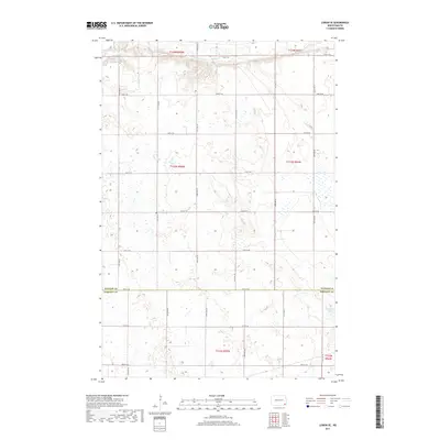
2017 Map of Lisbon SE
USGS Topo · Published 2017About this map
The Sheyenne River cuts a distinct valley across the northern reaches of this rural landscape, providing a sharp contrast to the surrounding prairie wetlands. This 2017 study illustrates the intricate water network of the Red River Valley region, where drainage from Dead Colt Cr feeds into the larger river system. To the southeast, Hultman Lake sits as a significant water body within the agricultural grid. The map highlights the political boundary between Ransom Co and Sargent Co, following the path of 78th St SE. The terrain is defined by a rigorous township and range system, with a network of section roads like 72nd St SE and Both St SE providing access to the fertile North Dakota plains.
Find a feature on this map
20 named features on this map. Tap any name to fly to it.
Don’t see what you’re looking for? This feature index may not catch every label — zoom into the map to look around manually.
Map Details
Editions of this 2017 Lisbon SE Map
This is the sole edition of this map. No revisions or reprints were ever made.
Other maps of this area

1907 · Wyndmere
USGS Topo · 1:125,000

1953 · Fargo
USGS Topo · 1:250,000

1956 · Fargo
USGS Topo · 1:250,000

1958 · Cayuga NW
USGS Topo · 1:24,000

1960 · Lisbon SE
USGS Topo · 1:24,000

1960 · Lisbon NE
USGS Topo · 1:24,000

1960 · Venlo
USGS Topo · 1:24,000

1960 · Milnor
USGS Topo · 1:24,000

1962 · Lisbon
USGS Topo · 1:24,000
1962 · Hoving
USGS Topo · 1:24,000
Featured Places
- Willey Township, ND
- Aliceton Township, ND
- Milnor Township, ND
- Big Bend Township, ND
- Scoville Township, ND