2021 Map of Litchfield
USGS Topo · Published 2021About this map
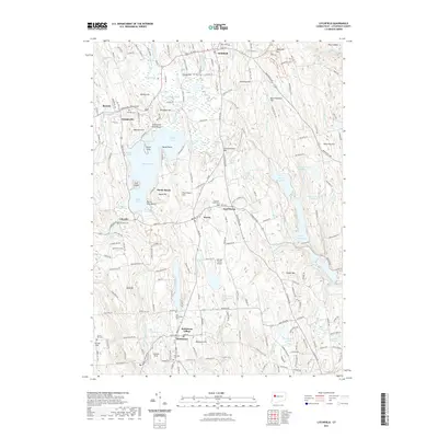
Bantam Lake serves as the geographic heart of this Litchfield County survey, its shoreline dotted with recreational landmarks like Litchfield Town Beach, Sandy Beach, and Morris Town Beach. The map details a classic New England landscape where established villages such as Litchfield, Morris, and Bethlehem are connected by a network of historic roads and family-named hills like Schermerhorn Hill and Wheeler Hill. The rural character of the region is punctuated by numerous small cemeteries, including Old Bethlehem Cem and Lakeside Cem, which provide valuable touchpoints for genealogical research.
Find a feature on this map
205 named features on this map. Tap any name to fly to it.
Don’t see what you’re looking for? This feature index may not catch every label — zoom into the map to look around manually.
Map Details
Editions of this 2021 Litchfield Map
This is the sole edition of this map. No revisions or reprints were ever made.
Other maps of this area

1892 · Winsted
USGS Topo · 1:62,500

1892 · Cornwall
USGS Topo · 1:62,500

1892 · New Milford
USGS Topo · 1:62,500

1893 · Waterbury
USGS Topo · 1:62,500

1893 · New Milford
USGS Topo · 1:62,500

1893 · Cornwall
USGS Topo · 1:62,500

1903 · Cornwall
USGS Topo · 1:62,500

1904 · New Milford
USGS Topo · 1:62,500

1904 · Waterbury
USGS Topo · 1:62,500

1904 · Litchfield
USGS Topo · 1:125,000