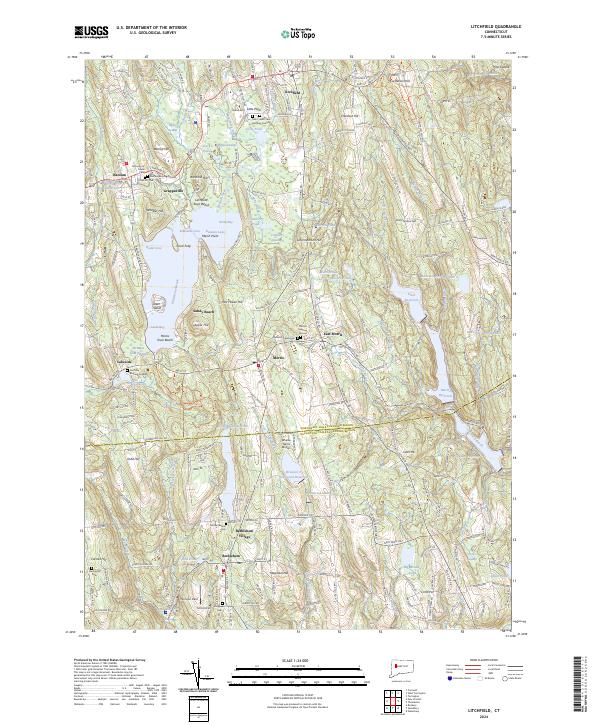
2024 Map of Litchfield
USGS Topo · Published 2024About this map
Bantam Lake serves as the central focal point for this Litchfield County landscape, surrounded by recreation areas like Morris Town Beach and notable points such as Deer Island and Point Folly. The map captures a high density of small settlements including Grappaville, Lakeside, and Bethlehem Village, reflecting the historic village-based development pattern of the Litchfield Hills. Genealogists will find a wealth of burial sites, from the centrally located Morris Burying Ground to the specialized Farband Jewish Cem and the older Footville Burying Ground. The terrain is marked by numerous drumlins and hills like Schermerhorn Hill and Magnolia Hill, which dictate the winding paths of roads such as West Rd. Significant water management is evident through a chain of reservoirs including Morris Reservoir and the Wigwam Reservoir in the southeast corner.
Find a feature on this map
82 named features on this map. Tap any name to fly to it.
Don’t see what you’re looking for? This feature index may not catch every label — zoom into the map to look around manually.
Map Details
Editions of this 2024 Litchfield Map
This is the sole edition of this map. No revisions or reprints were ever made.
Other maps of this area

1892 · Winsted
USGS Topo · 1:62,500

1892 · Cornwall
USGS Topo · 1:62,500

1892 · New Milford
USGS Topo · 1:62,500

1893 · Waterbury
USGS Topo · 1:62,500

1893 · New Milford
USGS Topo · 1:62,500

1893 · Cornwall
USGS Topo · 1:62,500

1903 · Cornwall
USGS Topo · 1:62,500

1904 · New Milford
USGS Topo · 1:62,500

1904 · Waterbury
USGS Topo · 1:62,500

1904 · Litchfield
USGS Topo · 1:125,000