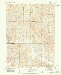
1951 Map of Litchfield SW
USGS Topo · Published 1953About this map
The tri-county junction of Custer, Sherman, and Buffalo Counties defines this rural landscape as it appeared in the early 1950s. This survey, part of the Missouri River Basin development program, reveals a dense network of one-room schoolhouses that served the surrounding agricultural sections. The distribution of institutions like Good Hope Sch, Oak Creek Sch, and Union Ridge Sch highlights the decentralized educational system of the era. Settlement patterns follow the draws and divides of the terrain, with Oak Creek and Dry Creek providing drainage through the hilly prairies. To the south, the community around Pleasant Valley Sch and the Pleasant Valley Ch stands as a primary social landmark. The presence of a small Cem and family-named schools like Brown Sch and Scott Center Sch offers significant value for genealogists tracing ancestors in these Central Nebraska townships.
Find a feature on this map
20 named features on this map. Tap any name to fly to it.
Don’t see what you’re looking for? This feature index may not catch every label — zoom into the map to look around manually.
Map Details
Editions of this 1951 Litchfield SW Map
2 editions found
Other maps of this area

1896 · Kearney
USGS Topo · 1:125,000

1951 · Litchfield SW
USGS Topo · 1:24,000

1951 · Litchfield NE
USGS Topo · 1:24,000

1951 · Hazard
USGS Topo · 1:24,000

1951 · Mason City
USGS Topo · 1:24,000

1951 · Mason City SE
USGS Topo · 1:24,000

1951 · Litchfield
USGS Topo · 1:24,000

1955 · Broken Bow
USGS Topo · 1:250,000

1955 · Grand Island
USGS Topo · 1:250,000

1956 · Broken Bow
USGS Topo · 1:250,000