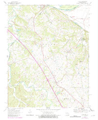
1970 Map of Lithium
USGS Topo · Published 1982About this map
Lithium and St Marys anchor this landscape along the border of Perry and Ste. Genevieve counties, where the high ground of the Saline township meets the wide bottomlands of the Mississippi River. The map highlights a complex hydrogeological environment, most notably the Ball Mill Resurgence and the winding course of South Fork Saline Creek. Evidence of earlier transport networks remains visible in the Old Giboney Railroad Grade, which contrasts with the active Burlington Northern line tracking the river.
Find a feature on this map
31 named features on this map. Tap any name to fly to it.
Don’t see what you’re looking for? This feature index may not catch every label — zoom into the map to look around manually.
Map Details
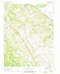
Editions of this 1970 Lithium Map
2 editions found
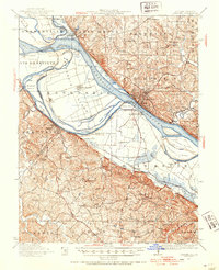
Other maps of this area

1907 · Weingarten
USGS Topo · 1:62,500

1909 · Weingarten
USGS Topo · 1:62,500

1910 · Higdon
USGS Topo · 1:62,500

1915 · Chester
USGS Topo · 1:62,500

1923 · Perryville
USGS Topo · 1:62,500

1924 · Perryville
USGS Topo · 1:62,500
1947 · Chester
USGS Topo · 1:62,500

1949 · Paducah
USGS Topo · 1:250,000

1949 · Rolla
USGS Topo · 1:250,000

1950 · Paducah
USGS Topo · 1:250,000