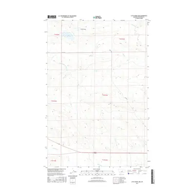
2017 Map of Little Bear Lake
USGS Topo · Published 2017About this map
Little Bear Lake serves as a focal point in this high plains landscape of Petroleum County, where the topography transitions into the sweeping expanse of Paradise Valley. The area's agricultural heritage is etched into the terrain by the Winnett Irrigation County Ditch, a vital piece of water management infrastructure that cuts across the western sections. Evidence of long-standing local transit is found in the east-west passage of Cemetery Rd, which traverses several seasonal drainages including Buffalo Cr and Dry Cr. To the south, the terrain becomes more incised at Whites Coulee near the banks of McDonald Cr. This 2017 survey by the U.S. Geological Survey documents the enduring ranching and irrigation patterns that have defined this portion of Montana for generations, providing a clear record of the intersection between natural waterways and human engineering.
Find a feature on this map
15 named features on this map. Tap any name to fly to it.
Don’t see what you’re looking for? This feature index may not catch every label — zoom into the map to look around manually.
Map Details
Editions of this 2017 Little Bear Lake Map
This is the sole edition of this map. No revisions or reprints were ever made.
Other maps of this area

1954 · Roundup
USGS Topo · 1:250,000

1954 · Lewistown
USGS Topo · 1:250,000

1958 · Roundup
USGS Topo · 1:250,000

1959 · Lewistown
USGS Topo · 1:250,000

1986 · Snoose Creek
USGS Topo · 1:24,000

1986 · Wild Horse Lake
USGS Topo · 1:24,000

1986 · Dry Blood Creek West
USGS Topo · 1:24,000

1986 · Winnett North
USGS Topo · 1:24,000

1986 · Dry Blood Creek East
USGS Topo · 1:24,000

1986 · Teigen
USGS Topo · 1:24,000