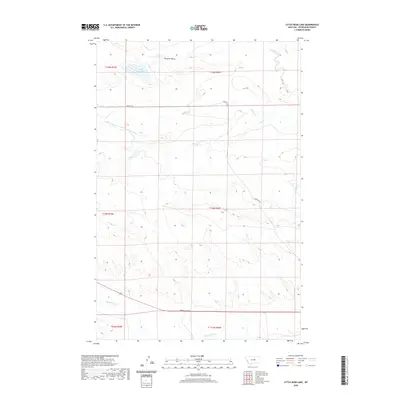
2020 Map of Little Bear Lake
USGS Topo · Published 2020About this map
Little Bear Lake and the sweeping terrain of Paradise Valley define this portion of Petroleum County, where the landscape is marked by an extensive network of seasonal drainages and irrigation infrastructure. The map details a rural environment dominated by water management and natural coulees, such as Whites Coulee in the south. Significant hydrologic features including Buffalo Cr, Box Elder Cr, and the Winnett Irrigation County Ditch illustrate the importance of water diversion in this arid region of Montana. Navigational markers such as Cemetery Rd provide the primary terrestrial coordinates within this sparsely populated expanse, connecting the various ranching or agricultural sections that make up the township and range grid across the central plains.
Find a feature on this map
15 named features on this map. Tap any name to fly to it.
Don’t see what you’re looking for? This feature index may not catch every label — zoom into the map to look around manually.
Map Details
Editions of this 2020 Little Bear Lake Map
This is the sole edition of this map. No revisions or reprints were ever made.
Other maps of this area

1954 · Roundup
USGS Topo · 1:250,000

1954 · Lewistown
USGS Topo · 1:250,000

1958 · Roundup
USGS Topo · 1:250,000

1959 · Lewistown
USGS Topo · 1:250,000

1986 · Snoose Creek
USGS Topo · 1:24,000

1986 · Wild Horse Lake
USGS Topo · 1:24,000

1986 · Dry Blood Creek West
USGS Topo · 1:24,000

1986 · Winnett North
USGS Topo · 1:24,000

1986 · Dry Blood Creek East
USGS Topo · 1:24,000

1986 · Teigen
USGS Topo · 1:24,000