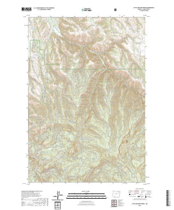
2024 Map of Little Beaver Creek
USGS Topo · Published 2024About this map
Whitman National Forest dominates this landscape in Union County, where complex ridge systems and seasonal water sources dictate the geography. The terrain is defined by prominent elevations such as Winter Ridge, Dry Beaver Ridge, and Coleman Ridge, which channel drainage into water bodies like Beaver Creek and the Grande Ronde River. The distribution of named water sources, including Winter Canyon Spring and Sheep Camp Spring, suggests a landscape long utilized for seasonal grazing and remote mountain travel.
Find a feature on this map
36 named features on this map. Tap any name to fly to it.
Don’t see what you’re looking for? This feature index may not catch every label — zoom into the map to look around manually.
Map Details
Editions of this 2024 Little Beaver Creek Map
This is the sole edition of this map. No revisions or reprints were ever made.
Other maps of this area

1953 · Pendleton
USGS Topo · 1:250,000

1956 · Pendleton
USGS Topo · 1:250,000

1963 · Hilgard
USGS Topo · 1:24,000

1964 · Mc Intyre Creek
USGS Topo · 1:24,000

1964 · Kamela SE
USGS Topo · 1:24,000

1965 · Limber Jim Creek
USGS Topo · 1:24,000

1965 · Marley Creek
USGS Topo · 1:24,000

1965 · Anthony Butte
USGS Topo · 1:24,000

1965 · Little Beaver Creek
USGS Topo · 1:24,000
1965 · La Grande Reservoir
USGS Topo · 1:24,000