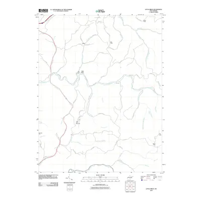
2010 Map of Little Birch
USGS Topo · Published 2010About this map
Little Birch serves as a central hub for this rural Braxton County landscape, where the Little Birch Post Office and nearby Little Birch Mountain anchor a community defined by its watercourses. The drainage patterns of the Little Birch River, Birch River, and Carpenter Fork dictate the winding routes of local roads like Erbacon Rd and the Old Turnpike Rd. To the north, the small settlement of Tesla sits at the junction of Telsa Rd and Catheaven Rd, while the southern reaches of the map are defined by the Bays community. The topography is notably marked by isolated peaks and ridges such as Pilot Knob, Barnette Hill, and Bug Ridge, illustrating the deeply dissected plateau character typical of central West Virginia. This 2010 survey reflects a modern snapshot of traditional Appalachian settlement patterns, where family-named landmarks like Hickory Flats and Barker Ridge persist alongside established county routes.
Find a feature on this map
64 named features on this map. Tap any name to fly to it.
Don’t see what you’re looking for? This feature index may not catch every label — zoom into the map to look around manually.
Map Details
Editions of this 2010 Little Birch Map
This is the sole edition of this map. No revisions or reprints were ever made.
Other maps of this area

1889 · Nicholas
USGS Topo · 1:125,000

1891 · Nicholas
USGS Topo · 1:125,000

1893 · Sutton
USGS Topo · 1:125,000

1901 · Nicholas
USGS Topo · 1:125,000

1908 · Gassaway
USGS Topo · 1:48,000

1908 · Sutton
USGS Topo · 1:48,000

1910 · Sutton Special
USGS Topo · 1:62,500

1910 · Gassaway
USGS Topo · 1:62,500

1913 · Summersville
USGS Topo · 1:48,000

1915 · Cowen
USGS Topo · 1:48,000