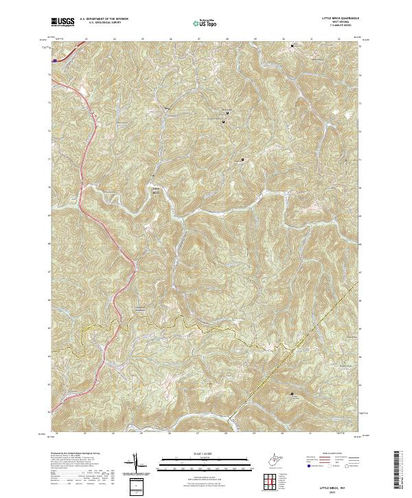
2023 Map of Little Birch
USGS Topo · Published 2023About this map
Little Birch River and its numerous tributaries, including Fisher Run and Laurel Run, carve through the deeply dissected landscape of the central Appalachian plateau. This area, located at the junction of Braxton, Nicholas, and Webster counties, is characterized by narrow ridgelines like Bug Ridge and Barker Ridge, where small settlements and family cemeteries are situated. The community of Little Birch lies along the river of the same name, while the village of Tesla is positioned to the north near Elizabeth Chapel Cem. Local history is preserved in scattered burial grounds such as Baker Ridge Cem and Harris Cem, which occupy high ground above the steep valleys. The southern portion of the map transitions toward the Birch River valley, marked by Little Birch Mountain and the prominent Pilot Knob, reflecting a pattern of isolated hilltop farming and timber-oriented topography.
Find a feature on this map
84 named features on this map. Tap any name to fly to it.
Don’t see what you’re looking for? This feature index may not catch every label — zoom into the map to look around manually.
Map Details
Editions of this 2023 Little Birch Map
This is the sole edition of this map. No revisions or reprints were ever made.
Other maps of this area

1889 · Nicholas
USGS Topo · 1:125,000

1891 · Nicholas
USGS Topo · 1:125,000

1893 · Sutton
USGS Topo · 1:125,000

1901 · Nicholas
USGS Topo · 1:125,000

1908 · Gassaway
USGS Topo · 1:48,000

1908 · Sutton
USGS Topo · 1:48,000

1910 · Sutton Special
USGS Topo · 1:62,500

1910 · Gassaway
USGS Topo · 1:62,500

1913 · Summersville
USGS Topo · 1:48,000

1915 · Cowen
USGS Topo · 1:48,000