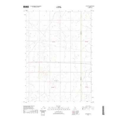
2020 Map of Little Butte
USGS Topo · Published 2020About this map
Little Butte rises as a prominent landmark in this desert landscape, serving as a focal point for the surrounding volcanic plains of eastern Idaho. The terrain transitions into the expansive Tractor Flat to the north, illustrating the vast open stretches characteristic of the Snake River Plain. This 2020 survey documents the intersection of public land survey systems and county boundaries, specifically where Bingham Co and Bonneville Co meet along a north-south line. The map captures a high degree of topographic detail across several townships, including t3n r33e and t2n r33e. Transportation is sparse, defined primarily by the straight trajectory of 1200 West Rd, reflecting a landscape dedicated to large-scale agriculture and open range rather than dense settlement.
Find a feature on this map
8 named features on this map. Tap any name to fly to it.
Don’t see what you’re looking for? This feature index may not catch every label — zoom into the map to look around manually.
Map Details
Editions of this 2020 Little Butte Map
This is the sole edition of this map. No revisions or reprints were ever made.
Other maps of this area

1955 · Idaho Falls
USGS Topo · 1:250,000

1958 · Idaho Falls
USGS Topo · 1:250,000

1964 · Kettle Butte NW
USGS Topo · 1:24,000

1964 · Kettle Butte SW
USGS Topo · 1:24,000

1973 · Little Butte NE
USGS Topo · 1:24,000

1973 · Little Butte NW
USGS Topo · 1:24,000

1973 · Middle Butte
USGS Topo · 1:24,000

1973 · Little Butte SW
USGS Topo · 1:24,000

1973 · Little Butte
USGS Topo · 1:24,000

1973 · Taber NE
USGS Topo · 1:24,000