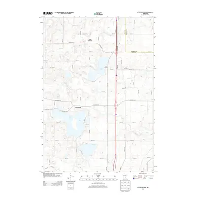
2013 Map of Little Chicago
USGS Topo · Published 2013About this map
Little Chicago and Millersburg anchor this landscape of glacial lakes and prairie streams in northern Rice County during the early 21st century. The map illustrates a transition between agricultural land and recreational water bodies, such as Circle Lake and Union Lake, which are connected by a network of local thoroughfares like Circle Lake TRL and Union Lake TRL. Notable landmarks include Camp Muskoday on the northern shore of Union Lake and the local burials at Rolling Green Cem and Forest Cem. The drainage patterns of the region are defined by Wolf Cr and Heath Cr, which flow through the rolling terrain. The presence of the small settlement of Comus in the southeast corner further details the rural residential distribution. This survey captures the modern road grid including Lonsdale Blvd W and Millersburg Blvd, which link these historical communities.
Find a feature on this map
64 named features on this map. Tap any name to fly to it.
Don’t see what you’re looking for? This feature index may not catch every label — zoom into the map to look around manually.
Map Details
Editions of this 2013 Little Chicago Map
This is the sole edition of this map. No revisions or reprints were ever made.
Other maps of this area

1953 · Saint Paul
USGS Topo · 1:250,000

1957 · Farmington
USGS Topo · 1:62,500

1957 · Prior Lake
USGS Topo · 1:62,500

1959 · Saint Paul
USGS Topo · 1:250,000

1960 · Faribault
USGS Topo · 1:24,000

1960 · Northfield
USGS Topo · 1:24,000

1960 · Cannon City
USGS Topo · 1:24,000

1960 · Shieldsville
USGS Topo · 1:24,000

1960 · Lonsdale
USGS Topo · 1:24,000

1960 · Little Chicago
USGS Topo · 1:24,000