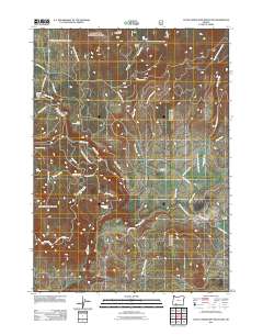
2011 Map of Little Chinquapin Mountain
USGS Topo · Published 2011About this map
Little Chinquapin Mountain stands at the center of this high-elevation landscape within the Rogue River National Frst, where water management and timber access define the local geography. The complex infrastructure of the Howard Prairie Canal and the Howard Prairie Dam highlights the mid-century engineering used to divert water across this mountainous divide. The map details a network of vital springs such as Big Springs, Jenny Creek Spring, and Fredenburg Spring that feed into Jenny Creek and Johnson Creek.
Find a feature on this map
34 named features on this map. Tap any name to fly to it.
Don’t see what you’re looking for? This feature index may not catch every label — zoom into the map to look around manually.
Map Details
Editions of this 2011 Little Chinquapin Mountain Map
This is the sole edition of this map. No revisions or reprints were ever made.
Other maps of this area

1891 · Ashland
USGS Topo · 1:250,000

1893 · Ashland
USGS Topo · 1:250,000

1897 · Ashland
USGS Topo · 1:250,000

1955 · Lake O' Woods
USGS Topo · 1:62,500

1955 · Surveyor Mtn
USGS Topo · 1:62,500

1955 · Hyatt Reservoir
USGS Topo · 1:62,500

1955 · Mt. Mc Loughlin
USGS Topo · 1:62,500

1955 · Medford
USGS Topo · 1:250,000

1957 · Medford
USGS Topo · 1:250,000

1958 · Medford
USGS Topo · 1:250,000