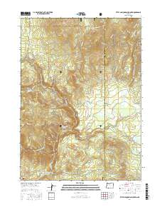
2017 Map of Little Chinquapin Mountain
USGS Topo · Published 2017About this map
The Rogue River National Forest defines this high-elevation landscape in the southern Oregon Cascades. The map shows a complex network of water sources and high peaks, including Little Chinquapin Mountain, Old Baldy, and Brush Mtn. This area is marked by numerous springs such as Fredenburg Spring, Bluejay Spring, and Dogwood Spring, which feed into a labyrinth of waterways like Jenny Creek and Green Cr. Evidence of water management and land use is visible through the Howard Prairie Canal and Johnson Prairie, reflecting the region's historical reliance on mountain watersheds for downstream irrigation and ranching. The small Pinehurst Cem stands as a solitary genealogical marker in the southwest, while the Pacific Crest National Scenic Trail winds through the northern peaks near Griffin Pass, tracing a traditional route across the divide between Jackson and Klamath counties.
Find a feature on this map
46 named features on this map. Tap any name to fly to it.
Don’t see what you’re looking for? This feature index may not catch every label — zoom into the map to look around manually.
Map Details
Editions of this 2017 Little Chinquapin Mountain Map
This is the sole edition of this map. No revisions or reprints were ever made.
Other maps of this area

1891 · Ashland
USGS Topo · 1:250,000

1893 · Ashland
USGS Topo · 1:250,000

1897 · Ashland
USGS Topo · 1:250,000

1955 · Lake O' Woods
USGS Topo · 1:62,500

1955 · Surveyor Mtn
USGS Topo · 1:62,500

1955 · Hyatt Reservoir
USGS Topo · 1:62,500

1955 · Mt. Mc Loughlin
USGS Topo · 1:62,500

1955 · Medford
USGS Topo · 1:250,000

1957 · Medford
USGS Topo · 1:250,000

1958 · Medford
USGS Topo · 1:250,000