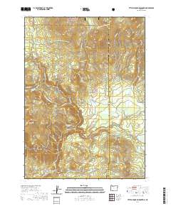
2020 Map of Little Chinquapin Mountain
USGS Topo · Published 2020About this map
Rogue River National Forest encompasses much of this high-elevation landscape along the boundary of Jackson and Klamath Counties. The terrain is defined by prominent peaks including Little Chinquapin Mountain, Old Baldy, and Brush Mountain. A significant segment of the Pacific Crest National Scenic Trail winds through the northern half of the quadrangle, crossing Griffin Pass and skirting Hyatt Lake. Water management and natural hydrology are central to the area, evidenced by the Howard Prairie Canal and a dense network of mountain streams such as Jenny Creek and Johnson Creek. The southern edge contains the Pinehurst Cemetery, providing a specific point of interest for genealogical research near the base of the mountain. Natural clearings like Johnson Prairie and Puckett Glade punctuate the timbered slopes, reflecting the diverse subalpine environment of the southern Cascades.
Find a feature on this map
38 named features on this map. Tap any name to fly to it.
Don’t see what you’re looking for? This feature index may not catch every label — zoom into the map to look around manually.
Map Details
Editions of this 2020 Little Chinquapin Mountain Map
This is the sole edition of this map. No revisions or reprints were ever made.
Other maps of this area

1891 · Ashland
USGS Topo · 1:250,000

1893 · Ashland
USGS Topo · 1:250,000

1897 · Ashland
USGS Topo · 1:250,000

1955 · Lake O' Woods
USGS Topo · 1:62,500

1955 · Surveyor Mtn
USGS Topo · 1:62,500

1955 · Hyatt Reservoir
USGS Topo · 1:62,500

1955 · Mt. Mc Loughlin
USGS Topo · 1:62,500

1955 · Medford
USGS Topo · 1:250,000

1957 · Medford
USGS Topo · 1:250,000

1958 · Medford
USGS Topo · 1:250,000