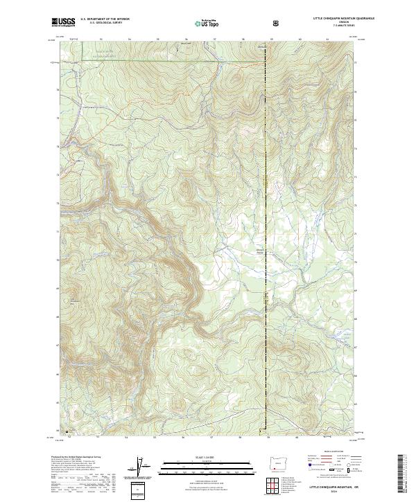
2024 Map of Little Chinquapin Mountain
USGS Topo · Published 2024About this map
The Cascade-Siskiyou National Monument and Rogue River National Forest meet in this 2024 survey of the southern Oregon highlands, centered on the crossing of the Jackson and Klamath county line. The landscape is defined by the protected waters of the Jenny Creek Wild and Scenic River, which winds through the central terrain alongside the Jenny Creek Rd. Evidence of the region's managed water resources appears in the north and south via the Howard Prairie Canal, while the high ridgeline is traced by the Pacific Crest National Scenic Trl as it passes through Griffin Pass. For genealogists and local historians, the Pinehurst Cem in the southwest corner provides a specific point of interest near the junction of Moon Prairie Rd, while the surrounding timberlands are marked by family-named landmarks like Puckett Glades and Johnson Prairie.
Find a feature on this map
49 named features on this map. Tap any name to fly to it.
Don’t see what you’re looking for? This feature index may not catch every label — zoom into the map to look around manually.
Map Details
Editions of this 2024 Little Chinquapin Mountain Map
This is the sole edition of this map. No revisions or reprints were ever made.
Other maps of this area

1891 · Ashland
USGS Topo · 1:250,000

1893 · Ashland
USGS Topo · 1:250,000

1897 · Ashland
USGS Topo · 1:250,000

1955 · Lake O' Woods
USGS Topo · 1:62,500

1955 · Surveyor Mtn
USGS Topo · 1:62,500

1955 · Hyatt Reservoir
USGS Topo · 1:62,500

1955 · Mt. Mc Loughlin
USGS Topo · 1:62,500

1955 · Medford
USGS Topo · 1:250,000

1957 · Medford
USGS Topo · 1:250,000

1958 · Medford
USGS Topo · 1:250,000